Serranía del Iñao National Park and Natural Area of Integrated Management

Venture into Bolivia’s protected areas to discover the magnificent Serranía del Iñao National Park, officially designated as both a Serranía del Iñao National Park and Natural Area of Integrated Management (in Spanish: Parque Nacional y Área Natural de Manejo Integrado Serranía del Iñao). It stands as an untouched haven of biodiversity and ancestral cultural traditions. This park, less renowned than many others in Latin America, offers you the chance to explore formidable landscapes and Bolivia’s rich biological diversity. We invite you to continue reading and unearth why this park should grace your list of essential destinations.

Introduction to Serranía del Iñao National Park

Serranía del Iñao National Park and Natural Area of Integrated Management

Geographical Location

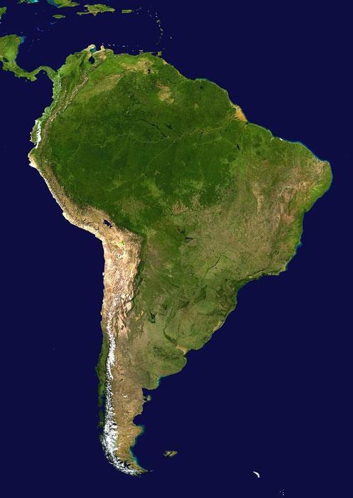
Situated in the eastern part of the Department of Chuquisaca, Bolivia, the park shares boundaries with the Department of Santa Cruz and encompasses the provinces of Luis Calvo, Hernando Siles, Tomina, and Belisario Boeto. Moreover, it encompasses the municipalities of Villa Vaca Guzmán, Monteagudo, Padilla, and Villa Serrano.

This strategic location in the heart of Bolivia grants the park a diverse array of landscapes and ecosystems, making it an enticing destination for nature enthusiasts and adventurers seeking to explore the wealth of biodiversity and ancestral cultural traditions of this region.

Geographical Coordinates

The geographical coordinates of Serranía del Iñao National Park span from the reference quadrant 18° 57′ 33.8″ South latitude, 64° 12′ 32.4″ West longitude, to 19° 45′ 48.5″ South latitude, 63° 42′ 12.8″ West longitude. These coordinates delineate the park’s area, covering an extensive region that includes awe-inspiring landscapes, rich biological diversity, and valuable cultural aspects of Bolivia. These coordinates are essential for precisely identifying and locating the park on maps and navigation systems.

History of the National Park

Serranía del Iñao National Park was established on May 28, 2004, under Law No. 2727, which granted it the official status of a national park in Bolivia. Its creation was a pivotal step in ensuring the protection of its abundant flora and fauna, as well as preserving the ancestral cultural traditions of the indigenous communities that have lived in harmony with nature for generations. Throughout the years, the park has been the subject of continuous conservation and protection efforts, driven by park authorities, local communities, and conservation organizations who strive to maintain its natural beauty and promote sustainable tourism. The main objectives for its establishment are as follows:

  1. Conserve the biodiversity of the ecosystems present in the park, ensuring the protection and preservation of the wildlife and flora inhabiting the region.
  2. Safeguard the exceptional values of the fauna, flora, genetic resources, and endangered species within the park’s boundaries, ensuring their survival and well-being.
  3. Preserve natural areas to facilitate scientific research studies and promote environmental education, fostering a greater understanding of ecosystems and the importance of their conservation.
  4. Protect the Serranías of Iñao, Ñahuañanca, and Khaska Orkho, three notable geographical areas within the park, and ensure that their natural and cultural characteristics remain intact.
  5. Preserve and contribute to the conservation of scenic, landscape, archaeological, and historical spaces within the protected area, valuing and safeguarding its cultural and natural heritage.
  6. Contribute to the recovery of areas that may be in a state of fragility or degradation, undertaking restoration and rehabilitation actions to maintain ecosystem integrity.

The park has a dual management category, meaning it is designated as both a "National Park" and a "Natural Area of Integrated Management" (ANMI). The designation of National Park primarily emphasizes biodiversity conservation and the protection of outstanding natural and cultural values, while the designation of Natural Area of Integrated Management (ANMI) implies that, in addition to its conservation function, the area also allows certain human activities and the sustainable use of natural resources.

Protected Area Size

The total area is approximately 262,769 hectares according to Geographic Information System (GIS) digital records. This figure may slightly differ from the 263,090-hectare value mentioned in the Creation Decree, but both numbers indicate that the park covers an extensive area harboring a diverse range of ecosystems and wildlife. This vast expanse of land provides a pristine refuge for biodiversity and holds significance for conservation and ecotourism in Bolivia.

Physical Features: Geography, Physiography, and Climate

Geology and Topography

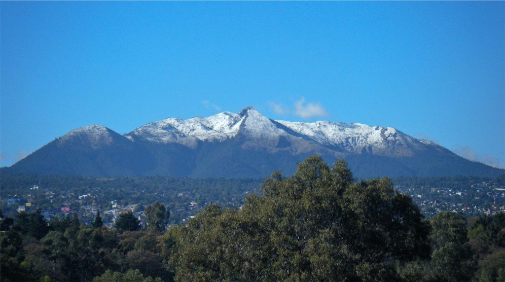
It stands out for its intricate topography. Steep mountains, winding valleys, and crystalline rivers create an unparalleled natural setting. The park’s geology unveils a history of millions of years, with rock formations reflecting different geological eras.

Physiography

Located in the physiographic province of the sub-Andean belt and on the final slopes of the Eastern Cordillera, its geography encompasses a wide range of altitudes, varying from 626 meters above sea level (masl) to 3,300 masl.

The sub-Andean belt is a region characterized by its proximity to the main Andean range, resulting in diverse and spectacular topography. In the park, this topography is manifested through serranías, which are tall and steep mountains, as well as hills and plains in the lower parts of the terrain.

This variation in altitudes and the diversity of the topography contribute to the formation of different types of ecosystems in the park, fostering a wide biodiversity of flora and fauna. Visitors to Serranía del Iñao National Park can enjoy breathtaking landscapes ranging from high summits to low and flat areas, providing a unique experience of nature and scenic beauty.

Hydrology

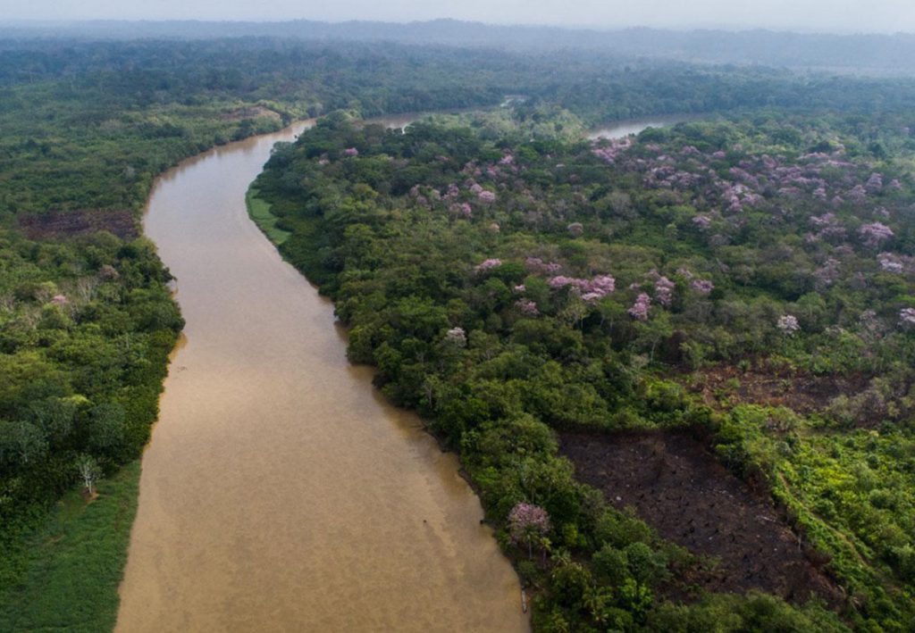
It is part of the Amazon River Basin, an extensive hydrographic region that spans a significant portion of the South American continent. Within this macro-region, most of its hydrographic network lies within the basins of two important rivers: the Grande or Guapay River and the Parapeti River.

Among the main sub-basins present in the park are the Azero, Bañado, Limón, Ñancahuazu, Pilli Pilii, Arrozal, and El Abra rivers, among others. These rivers and streams traverse the park and play a crucial role in supporting wildlife and the diversity of ecosystems in the protected area.

The presence of an extensive hydrographic network in Serranía del Iñao contributes to the formation of diverse landscapes and habitats, such as humid forests, savannas, and other aquatic ecosystems, further enhancing its value as a biodiversity refuge and a vital water source for the flora and fauna residing there.

Climate

The park exhibits a diverse climate, with subhumid and humid characteristics in different areas. The average annual precipitation varies between 900 to 1,200 mm in some zones, while in the highlands where humid and cloud forests are found, precipitation can reach or even exceed 2,500 mm per year. These climatic conditions contribute to the richness of biodiversity and the lush vegetation found in the protected area.

Regarding temperatures, the region experiences variations based on topography. In the lowlands, average annual temperatures range around 24°C, providing a warm environment. However, as we ascend in altitude towards the higher parts of the park, temperatures significantly decrease, with values fluctuating around 14°C, creating a cooler environment more suitable for the humid and cloud forests found at these altitudes.

Biodiversity of Serranía del Iñao National Park

Ecoregions

Located in a privileged position, the park encompasses a variety of ecoregions and sub-ecoregions. These distinct ecological areas further enrich the diversity and natural beauty of the park. The three ecoregions present in the park are:

  1. Gran Chaco: This ecoregion extends across a wide area that includes parts of Bolivia, Paraguay, Argentina, and Brazil. In Serranía del Iñao National Park, the specific sub-ecoregion is also known as Gran Chaco, characterized by typical Chaco landscapes, including savannas and dry forests.
  2. Tucuman-Bolivian Forest: Known for its humid and cloud montane forests. In the park, the Tucuman-Bolivian Forest sub-ecoregion contributes to the presence of wooded and lush areas in the high parts of the protected area.
  3. Serrano Chaco: This is a transition zone between the Chaco and mountainous areas, characterized by mixed vegetation and wetter conditions than the typical Chaco. In the park, the Serrano Chaco sub-ecoregion represents a transitional area that holds features of both ecoregions.

These ecoregions and sub-ecoregions contribute to the preservation of diverse ecosystems and the existence of a wide variety of flora and fauna, turning the protected area into a biodiversity treasure in Bolivia.

Flora

The park harbors a rich and diverse variety of flora adapted to the different microclimates and ecosystems present in the region. Approximately 102 species of flora have been recorded, and an estimated 200 species of higher plants are believed to exist in the protected area.

Among the most distinctive vegetation are queñua forests (Polylepis tarapacana) and yareta fields (Azorella compacta), both species that are endangered. Relictual queñua forests can even be observed at altitudes higher than 4,800 masl in microclimatic enclaves, primarily on rocky areas facing North, East, and Northeast, near Mama Khumu lagoon and on the lower slopes of Uturuncu volcano.

Yareta fields, another threatened type of vegetation, are found in mountainous areas and rock formations, especially around Kollpa, Totoral, and Kalina lagoons, and to the west of the Reserve on the Chilean border, in the Polques, Chalviri, and Laguna Hedionda mountain ranges.

In addition to these endangered species, mixed xeromorphic shrublands with Polylepis tarapacana, Fabiana bryoides, Baccharis incarum, Cherdosoma jodopappa, and cushions of Azorella compacta are also present, mainly in rocky microclimates.

Regarding "tholares," which are communities of xeromorphic shrublands, they are found in the northeast area in the Quetena river valley, where several species like Qhiru thola (Parastrephia lepidophyla), Lejia thola (Baccharis incarum), and Koa thola (Fabiana squamata) are threatened due to domestic and commercial extraction.

The bofedales, ecologically important wetland areas, are distributed along the edges of slow-moving streams, rivers, and lakes, with the Quetena Grande bofedal being the most significant in terms of surface area and conservation status. These bofedales are dominated by species such as Oxychloe andina and Puccinella frígida.

The tussock grasslands are mainly composed of species such as Stipa frigida, Festuca orthophylla, and Senecio puchii. Additionally, hygrophilous tussock grasslands can be found in less-drained areas of the plains and in transition to bofedales, characterized by Deyeuxia curvula and Werneria pomposa.

Aquatic communities are also notable in the park. They are found in shallow waters on the periphery of ponds, lagoons, and very slow-moving streams, as well as in deeper or slightly flowing waters. Species like Ranunculus unifloris, Lilaeopsis macloviana, Myriophyllum quitensis, and Potamogeton filiformis can be observed in these aquatic environments.

Fauna

The park is home to a fascinating diversity of fauna distributed around the natural values present in the protected area, such as lagoons and bofedales, which are vital habitats for many species. The Reserve’s Monitoring Program has recorded over 105 species of fauna in the park, highlighting the importance of this area as a biodiversity refuge in Bolivia.

Among the fauna species found in the park, some of the most prominent ones include:

  1. Birds: The park is home to various bird species, including raptors such as the Andean condor, golden eagle, and peregrine falcon. Aquatic birds like flamingos, ducks, and gulls can also be found in the lagoons and wetlands.
  2. Mammals: Emblematic mammal species residing in the park include the jaguar, spectacled bear, puma, and tapir. There is also a variety of other mammals such as the marsh deer, Andean fox, coati, wild rabbit, and various bat species.
  3. Reptiles and Amphibians: The park hosts a diversity of reptiles and amphibians, including snakes, lizards, frogs, and toads. Some species are endemic and adapted to the specific conditions of this ecosystem.
  4. Fish: Different fish species are also present in the park’s lagoons and rivers, contributing to the richness of aquatic fauna in the area.

It is important to note that the park serves as a natural habitat for many threatened or endangered species, making its conservation crucial for preserving biodiversity and ecological balance in this region of Bolivia.

Tourist Attractions and Main Activities

Che Guevara Route

The Che Guevara Route is a historic and emblematic trail within Serranía del Iñao National Park, encompassing significant locations where Che Guevara’s guerrilla warfare took place in the 1960s. This route offers visitors the opportunity to delve into revolutionary history and Che’s legacy in Bolivia. The places that make up this route include:

  1. Pacobarenda: One of the camps where Che Guevara’s guerrilla group established themselves during their revolutionary struggle. It’s a key point on the route providing insight into the conditions the guerrillas lived in.
  2. Pincal: Used by Che Guevara’s guerrilla, it is an important part of their historic route.
  3. Morteros: One of the points along the route where combat and actions took place during the guerrilla warfare.
  4. Cahuazu: A strategic site where the guerrillas carried out their operations and engagements.
  5. Achirarenda: A significant location on the route where the guerrilla also left its mark.
  6. Río Ñancahuazu: An important river for the guerrilla’s survival, providing water and natural resources.
  7. Casa de calamina en el Cajón: Specifically, this house was a key base used by Che Guevara and his group during the guerrilla campaign.

The Che Guevara Route offers a unique experience for those interested in Che Guevara’s history and life, allowing them to follow in the footsteps of his struggles and understand the historical context in which the guerrilla warfare unfolded. Additionally, this route also provides the opportunity to explore the natural beauty of the National Park while learning about one of the most significant events in Bolivian history.

Río Grande

Located near the community of Itapochi, offers opportunities for fishing activities, where species such as sábalo, dorado, and surubí can be tasted. Additionally, the river’s flow allows for boat rides and observation of riverside birds, making it an attractive spot for nature enthusiasts.

Puente Azero – Las Juntas with Río Grande

This is a suggested route for those seeking adventure tourism, such as rafting and kayaking, as well as for ecotourism enthusiasts.

Guaraní Communities of Ity and Aguayrenda

These communities offer the opportunity to experience cultural immersion, allowing visitors to learn about their way of life, community organization, use of natural resources, and other cultural aspects of the Guaraní people.

Iripití Thermal Springs

Located 8 km southeast of the Iripití community, the Iripití Thermal Springs offer a relaxing and therapeutic experience in a natural setting.

Serranías del Iñao, Khaska Orkho, and Yahuñanca

These areas feature impressive landscapes and unique geological formations, with traces of animals such as tapirs, lions, and jucumaris.

Phajcha "El Limón"

Located approximately 2 hours by vehicle from Monteagudo, this spot is accessible year-round and offers attractive landscapes, likely including waterfalls and beautiful natural surroundings.

Río Azero Norte Riverside Resort

Located 38 km from Monteagudo, this resort provides an opportunity to enjoy a natural riverside getaway along the Río Azero.

Laguna Iñao

Laguna Iñao is a place of great importance and beauty within Serranía del Iñao National Park. It’s near the Entierrillos community and stands out for its location and altitude, making it a vital habitat for the local fauna.

The lagoon serves as a strategic point for the park’s wildlife, providing a valuable water and food resource for many animal species. It’s an ideal spot for birdwatching, making it a paradise for ornithology enthusiasts.

In addition to its ecological significance, Laguna Iñao holds a mystical charm related to weather changes, which has been observed and appreciated by the local population of Villa Vaca Guzmán. This connection with the local community adds cultural and emotional value to the location.

Vaca Guzmán

Azero Norte/Fishing: The Río Azero Norte is located 34 km from the town of Monteagudo and is known for being a swift-flowing river suitable for sports fishing. Anglers can find species such as sábalo, catfish, surubí, dorado, and more. The ideal fishing season is during winter. Apart from fishing, the river also offers opportunities for adventure sports like canoeing and rafting, making it an attractive spot for nature and extreme sports enthusiasts. (Municipality of Monteagudo and Padilla).

Guaraní World: The community of Ity, along with other communities like Aguayrenda and Teperillas, offers the chance to experience Guaraní culture and learn about their way of life, traditions, and customs. In the agricultural sector, visitors can observe remnants of funerary sites and figures, adding cultural and historical appeal to the experience. Getting to know and interact with these communities allows visitors to immerse themselves in the rich culture and heritage of the Guaraní people. (Municipality of Vaca Guzmán).

Ruins of Ilinchupa

These Inca ruins are located about 23 km from the city of Monteagudo. They offer an exceptional view from their lookout point, providing a unique perspective of the surrounding landscape. These ruins are an archaeological treasure that allows visitors to connect with the ancient history of the region and appreciate the cultural legacy left by pre-Hispanic civilizations. (Municipality of Monteagudo and V. Vaca Guzmán).

Serranía del Iñao National Park and its surroundings offer a wide variety of experiences, from river adventures to immersing oneself in the culture and history of local communities. Each mentioned location enhances the visit to this beautiful park and allows tourists to connect with the nature and rich cultural diversity of Bolivia.

Panoramic Viewpoints

Among the main attractions are the natural viewpoints from which you can enjoy breathtaking views of the mountain range, the trails that traverse different ecosystems, and the rivers where you can enjoy a refreshing swim. A visit to Serranía del Iñao National Park is an immersion in the natural beauty of Bolivia.

Park Video

Culture and Local Communities

Local Indigenous Towns and Communities

Serranía del Iñao National Park is not only a place of great natural beauty but also a home to several indigenous communities. These communities have lived in harmony with nature for generations, and their culture and traditions are an essential part of the park’s charm.

Cultural Importance and Traditions

The park has a rich cultural heritage. Local communities have kept their traditions alive through generations, from crafting to ancestral ceremonies. Interacting with local communities is one of the most rewarding experiences for visitors.

Community Conservation Projects

Local communities also play a key role in park conservation. They engage in various conservation projects aimed at protecting the park’s biodiversity and maintaining their traditional way of life.

Conservation and Management of the National Park

Threats and Conservation Challenges

Like many natural spaces, Serranía del Iñao National Park faces various threats, including climate change, deforestation, and illegal hunting. These challenges require careful management and ongoing conservation efforts.

Conservation and Protection Efforts

There is a constant commitment to protect and conserve the park. Park authorities, along with local communities and conservation organizations, work to safeguard the park’s biodiversity and promote sustainable tourism.

Scientific Research and Educational Programs

The park is an important center for research and education. Scientists conduct research on the park’s biodiversity and ecosystems, and educational programs aim to raise awareness about the importance of conservation.

How to Get There and Plan Your Visit

Access Routes

The access routes to Serranía del Iñao National Park are as follows:

  1. From the city of Sucre: You can access the park by taking the Jaime Mendoza main road, which connects the cities of Sucre and Camiri. Along this route, there are several secondary roads that are passable year-round, although caution should be exercised during the rainy season. This route provides a convenient way to reach the park from Bolivia’s capital city, Sucre.
  2. From the city of Santa Cruz: An option from Santa Cruz is to take the paved road (240 km) towards Yacuiba. Then, turn off at the Ipati Junction and continue on a gravel road (40 km) until you reach the town of Muyupampa. From Muyupampa, you will reach the entrance of the national park, making a total of 280 km from Santa Cruz. This route offers an alternative way to access the park, especially for those located in the city of Santa Cruz.

Both routes allow visitors to reach Serranía del Iñao and enjoy its natural beauty, biodiversity, and tourist attractions. The combination of mountains, rivers, lakes, and the cultural richness of local communities makes the park a special destination for those seeking a unique experience in Bolivia.

Tips for Visitors: Preparation and Safety

When planning your visit, it’s important to consider the climate, altitude, and remote location of the park. It’s recommended to bring warm and rainproof clothing, drinking water, food, and a map of the park. Always remember to respect nature and follow the park rules to ensure a safe and enjoyable visit.

Accommodation and Services Near the Park

There are several accommodations near the park, ranging from luxury hotels to more budget-friendly hostels. There are also restaurants and stores where you can stock up on supplies for your visit. Keep in mind that services within the park are limited, so arriving prepared is advisable.

In Monteagudo

  1. Hotel Los Pinos: A cozy hotel in the center of Monteagudo, offering comfortable rooms and basic services for travelers.
  2. Hostal El Parador: An affordable hostel with simple yet comfortable rooms, ideal for budget-conscious travelers.
  3. Hospedaje Casa Grande: A family-friendly lodging option where guests can experience local hospitality and a homely atmosphere.

In Villa Vaca Guzmán

  1. Hostal Villa Vaca Guzmán: A small hostel with a peaceful and welcoming atmosphere, located near the main square of the town.
  2. Hospedaje La Casona: A charming place where visitors can enjoy a relaxed and family-oriented environment.

In Muyupampa

  1. Hospedaje Muyupampa: A simple yet comfortable lodging option, perfect for those who wish to be close to the starting point of the Che Guevara Route.
  2. Hostal Los Amigos: A cozy and friendly place where travelers can share experiences and enjoy the hospitality of the hosts.

It’s important to note that the availability of accommodations in these towns may vary, and it’s recommended to make reservations in advance, especially during the peak tourist season. Additionally, some lodgings might be more basic and rustic due to the remote location of the protected area. However, these options provide an opportunity to enjoy an authentic stay in close proximity to nature and local culture.

Photo Gallery