In the center of Ecuador rises the mighty Cotopaxi volcano, surrounded by the vast and diverse ecosystem that makes up the Cotopaxi National Park. This park is not only a destination for adventurers and nature lovers but also a space of immense ecological and cultural importance. With its impressive landscapes, rich biodiversity, and unique opportunities for outdoor tourism, it invites its visitors to discover its towering heights and valleys. From hikes to the summit of the volcano to tranquil observations of the local flora and fauna, this article offers a comprehensive guide to exploring one of Ecuador’s most iconic destinations.
Content
- 1 History of Cotopaxi National Park
- 2 Geographical Location
- 3 General Information
- 4 Geography and Biodiversity
- 5 Activities and Tourist Attractions
- 5.1 Ruins of the Citadel of the Puruháes
- 5.2 Trekking and Summiting Cotopaxi Volcano
- 5.3 Visit to the Glaciers of Cotopaxi Volcano
- 5.4 Ascent Route to Rumiñahui Volcano
- 5.5 Ascent Route to Sincholagua Volcano
- 5.6 Paragliding from Cotopaxi Volcano’s Crater
- 5.7 Paragliding from the Summit of Putzalahua Volcano
- 5.8 Bike Descent from Cotopaxi Refuge
- 6 Recommended Family Activities
- 7 What to See and Do in and near Cotopaxi National Park (Different Excursions)
- 7.1 Caspi: Natural Lookout and Birdwatching
- 7.2 San Juan de Pastocalle
- 7.3 Cunuyacu Hot Springs
- 7.4 Illinizas Reserve
- 7.5 San Francisco Church
- 7.6 Santo Domingo Church
- 7.7 La Merced Church
- 7.8 Latacunga Cathedral
- 7.9 Archaeological and Ethnographic Museums of the Casa de la Cultura
- 7.10 Chalupas
- 7.11 Los Búhos Church Cave
- 7.12 EL BOLICHE National Recreation Area
- 7.13 Sigchos
- 7.14 Sinchaguasín Lookout
- 7.15 Sinchaguasín Hill
- 7.16 Devil’s Waterfall
- 7.17 Los Illinizas Ecological Reserve: Explore the Pristine Nature of the Andes
- 8 Accommodation in Cotopaxi
- 9 When to Visit Cotopaxi
History of Cotopaxi National Park
Cotopaxi National Park was established to protect and preserve the area around the active Ecuadorian volcano. Its history intertwines with that of the indigenous communities that have inhabited this region for centuries, considering Cotopaxi as a sacred site. The creation of the park has been a significant milestone in Ecuador’s conservation efforts, ensuring the protection of its unique biodiversity and stunning landscapes for future generations.
Geographical Location
Cotopaxi National Park is located in Ecuador, encompassing territories of the provinces of Cotopaxi, Pichincha, and Napo. It is situated within the Northern Andes Paramo ecoregion.
Its geographical coordinates are approximately 0°41’03″S latitude and 78°26’14″W longitude.
Regarding its climate, the park experiences a wide range of temperatures, ranging from historical lows of -10°C on the glaciers to 20°C on the sunniest days over the lower páramo, varying according to altitude.
General Information
- Administration: Ministry of the Environment
- Protection Status: National park
- Date of Creation: August 11, 1975
- Legislation:
- Official Creation Registry: Interministerial Agreement No. 1 0259-A of 08/11, Official Registry No. 876 of 08/27/1975
- Official Modification Registry: Official Registry No. 69 of November 20, 1979; Official Registry No. 10 of August 23, 1996
- Area: 32,255 hectares.
Geography and Biodiversity
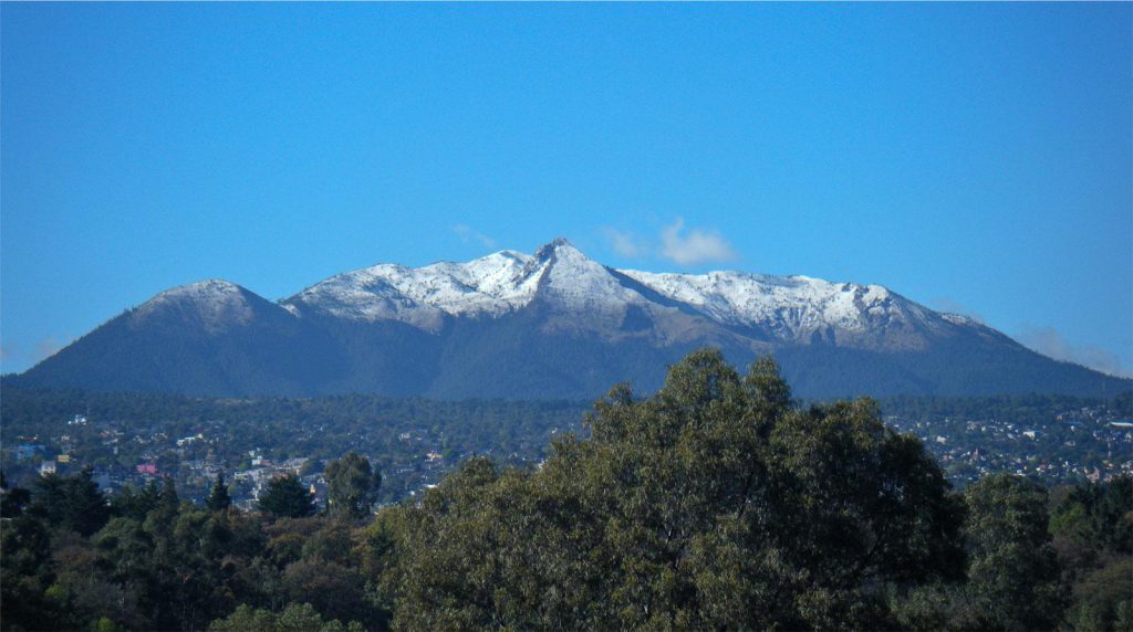
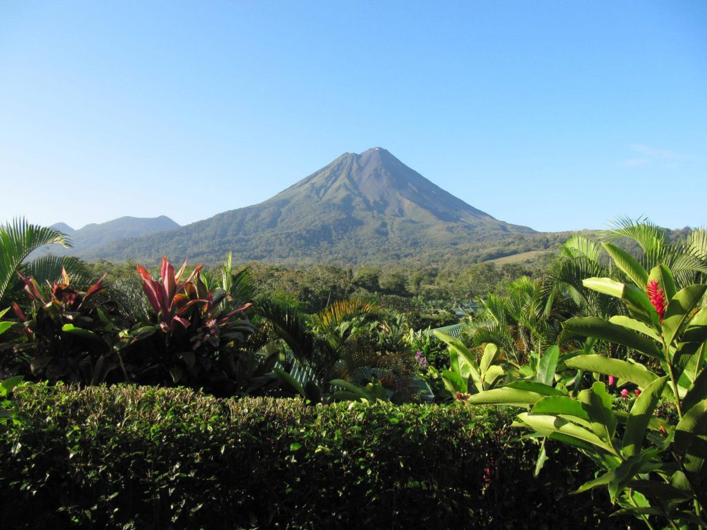
Cotopaxi National Park is characterized by its variety of ecosystems, from highlands to cloud forests, home to a wide range of flora and fauna species. The Cotopaxi volcano, which gives its name to the park, is an impressive snow-capped cone that dominates the landscape and attracts mountaineers from around the world. The park’s biodiversity includes endemic and endangered species, making it an important center for conservation and scientific study, being one of Ecuador’s most important protected areas along with the Cajas National Park, also located in Ecuador, although the latter is quite distant from Cotopaxi.
Flora
The flora and vegetation coverage of Cotopaxi National Park reflect a variety of ecosystems along different altitudes. In the lower montane forests, between 3400 and 3900 meters above sea level, there are low-height trees such as Oreopanax andreanus and Prunus serotina, along with species like Stipa ichu and mosses.
The sub-Andean pluvial páramo, located between 3900 and 4400 meters above sea level, is dominated by páramo grass, lichens, and clubmosses. Further up, between 4400 and 4700 meters above sea level, the Andean pluvial tundra presents vegetative colonies, cushions (Werneria sp.), and Senecio (Culcitium canescens), as well as mosses and lichens. Above this zone is the snow line, where there is no vegetation due to the presence of snow and glaciers.
Outside the park boundaries, large pine plantations have been established for commercial purposes since 1976. Although mostly outside the park, these plantations have altered natural habitats and ecosystem dynamics, creating microhabitats that have displaced characteristic páramo vegetation and have served as refuge for some animal species, such as the white-tailed deer and various small birds.
Fauna
Cotopaxi hosts diverse fauna, including mammals such as the llama, wild horses in the northern and eastern sectors, white-tailed deer, spectacled bear, pumas, wild rabbits, paramo wolves, cervicabras, skunks, opossums, mole rats, and Andean weasels.
Prominent bird species include the hawk, falcon, duck, owl, barn owl, caracara, condor, Andean toucan, and various species of hummingbirds.
Activities and Tourist Attractions
The park offers a wide range of outdoor activities, from hiking through its varied landscapes to high-altitude mountain climbing on Cotopaxi volcano. Visitors can also enjoy birdwatching, mountain biking, and horseback riding through the picturesque surroundings. The routes and trails are designed for all skill levels, offering everything from gentle walks to challenging volcano climbs.
Ruins of the Citadel of the Puruháes
The Ruins of the Citadel of the Puruháes are an important archaeological site located within Cotopaxi National Park, in Ecuador. These ruins represent the remains of an ancient citadel built by the Puruhá civilization, an indigenous ethnic group that inhabited the central region of Ecuador before the arrival of the Spanish.
The Citadel of the Puruháes is a fascinating testimony to the architectural skill and social organization of this ancient civilization. It is believed that the citadel had defensive and ceremonial purposes, and its construction dates back several centuries.
The archaeological site offers visitors the opportunity to explore ancient structures, such as stone walls, terraces, and possibly ceremonial temples. Additionally, the ruins provide invaluable information about the history and culture of the ancient inhabitants of the region.
The Ruins of the Citadel of the Puruháes are a fascinating destination for archaeology enthusiasts and those interested in immersing themselves in Ecuador’s pre-Columbian history. Its location within Cotopaxi National Park also allows visitors to enjoy the stunning natural beauty of the area while exploring this important historical site.
Trekking and Summiting Cotopaxi Volcano
Ascending to the crater of Cotopaxi volcano is an unforgettable experience in Ecuador. The summit sits at 5897 meters high and requires physical preparation, acclimatization, and a professional guide.
Ascending the volcano is an unforgettable experience when visiting Ecuador, with its distant summit unwavering. To undertake this activity, proper physical preparation, correct acclimatization, and, above all, the guidance of an experienced professional mountain guide are necessary. Guides can be hired in the park to undertake this demanding activity with full safety.
Once registered at the entrance of Cotopaxi National Park, we can begin the journey to the refuge, starting from the refuge parking lot at 4600 meters, where a short but challenging hike leads us to the José Ribas refuge at 4800 meters. Typically, arriving early helps with better altitude adaptation and participation in a glacier training school.
It’s ideal to rest for a few hours at the refuge and, with all the high-altitude gear ready, begin the ascent to the summit of Cotopaxi at midnight. This stretch can take between 6 and 8 hours approximately, so it’s advisable to reach the summit at dawn to enjoy spectacular views and the immense crater, allowing enough time for a calm descent.
Reaching the summit is an emotional experience that rewards effort and determination. However, weather conditions, prior physical preparation, and the state of the glacier can make the ascent challenging, with the mountain guide deciding whether to continue in such situations.
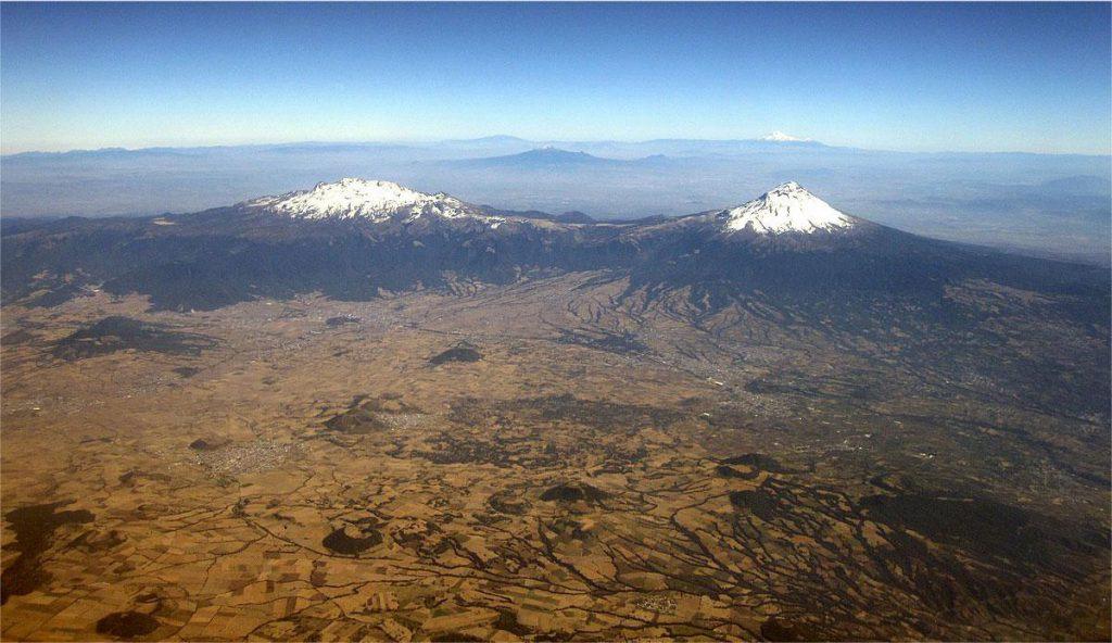
From the summit, at the crater of Cotopaxi Volcano, the descent to the refuge is quicker, taking about 2 hours. When the sky is clear, impressive landscapes with views of several mountains that make up the famous avenue of the volcanoes can be appreciated.
Visit to the Glaciers of Cotopaxi Volcano
A visit to the glaciers of Cotopaxi Volcano offers an unforgettable experience in Cotopaxi National Park. Here’s how to enjoy this adventure:
- Ascend to José Ribas Refuge: one of the most popular activities is to ascend to José Ribas Refuge, located at 4800 meters above sea level. It’s important to be acclimatized or willing to face the altitude. Usually, you can drive up to the parking lot at 4600 meters. From there, there are trails leading to the refuge; one is steeper and more direct, and the other zigzags and takes longer but is less exposed to the icy winds of the snowy area. Simply reaching the refuge is an achievement, and the alpine atmosphere is filled with enthusiastic climbers ready to conquer the summit of Cotopaxi volcano.
- Visit the Glacier: once at the refuge, after catching your breath, you can take a hike to visit one of the nearby glaciers. A trail on the backside of the refuge leads to this impressive location. Depending on the time of year, snow can be found near the refuge. Upon reaching Cotopaxi Glacier, you’ll be amazed by the contrast between the volcanic earth of the volcano and the turquoise blue of the glacier ice, created by the light passing through it. Like many glaciers in the world, Cotopaxi’s glacier retreats each year, making each visit unique as the glacier’s appearance changes over time.
Ascent Route to Rumiñahui Volcano
This trek begins at Limpiopungo Lagoon at 3800 meters and offers exceptional views. The trail traverses the paramo, teeming with life and unique flora, before reaching the summit at 4722 meters.
The ascent to Rumiñahui starts at Limpiopungo Lagoon at 3800 meters above sea level. The trail to the central summit of the volcano is on the other side of the lagoon. If you’re lucky, from this point, you can enjoy exceptional views of Cotopaxi Volcano.
The first part of the trail, known as "chaquiñan" in Ecuador, is relatively easy and crosses the paramo, an ecosystem full of life that has adapted to the harsh conditions of altitude, cold, and humidity. Here, it’s common to find unique plants growing in cushion-like formations, creating microclimates for younger ones. You’ll also encounter the chuquiragua, or Andean flower, known for its medicinal properties. Cotopaxi National Park was largely created to protect this ecosystem.
As you progress in the ascent, you’ll notice vegetation beginning to disappear, and the terrain becomes rockier. Due to the instability of the rocks, it’s essential to wear a helmet for the last stretch of the trail, which takes you through almost unrecognizable paths where you’ll need to use your hands to climb.
The estimated time to complete this activity ranges from 6 to 8 hours. The central summit of the volcano is at 4630 meters above sea level, while the highest summit reaches 4722 meters. The views from here are impressive, albeit dizzying. With luck, you’ll be able to spot other volcanoes like Ilinizas or Corazón.
The descent and return are done along the same trail until reaching the lagoon or the camping area.
Ascent Route to Sincholagua Volcano
Sincholagua Volcano, near Cotopaxi National Park, offers a less popular but equally impressive challenge. The ascent, taking between 6 and 8 hours, offers panoramic views of the Eastern Cordillera.
Though less popular among hikers due to limited access roads, this volcano, located near Cotopaxi National Park, offers breathtaking views and spectacular landscapes. It can be accessed through the Pedregal sector or through the interior of the national park towards Yanahurco hacienda. The latter route offers the most beautiful views but is also the longest.
The summit of Sincholagua is at 4873 meters above sea level, and it will take between 6 and 8 hours to complete the ascent, depending on whether a base camp is set up. The final stretch is very unstable, so wearing a helmet and being guided by a local expert is recommended to ensure the success of the activity.
The volcano is near the Eastern Cordillera and is influenced by the humid currents from the Amazon, creating an unstable and cloudy climate. Notable on the Sincholagua route are the landscapes and the opportunity to observe Antisana and Cotopaxi volcanoes from above.
Paragliding from Cotopaxi Volcano’s Crater
Although not a regulated activity, some guides and professionals engage in paragliding from the summit of Cotopaxi, offering incredible views of the region.
Paragliding from the crater of Cotopaxi Volcano should always be done with local guides who know the conditions of the place perfectly. One of the pioneers in making this descent from the summit of Cotopaxi in paragliding was Jorge Núñez, a high mountain guide and member of the UIAGM, who descended accompanied by several colleagues and guide friends in 2020.
Paragliding from the Summit of Putzalahua Volcano
If you’re a paragliding enthusiast, in the Cotopaxi province, at the summit of Putzalahua, you can also engage in this activity. Putzalahua is located very close to the city of Latacunga. Although this activity isn’t officially regulated, it’s carried out by experienced individuals with knowledge of free flight.
Bike Descent from Cotopaxi Refuge
Descending by bike from the refuge at 4600 meters to the southern entrance at 3400 meters is an exciting and popular activity among foreign visitors. It offers breathtaking landscapes and an unforgettable experience. The activity has a 1000-meter vertical drop!
Though the descent isn’t particularly challenging, it requires taking many precautions, especially because the road is dirt and gravel, and in the initial stage, the path is quite steep. It’s important to be alert to the presence of other vehicles going up or down from the refuge, as there are no exclusive tracks for mountain bikes.
Despite the challenges, the landscapes and the feeling of riding at the foot of the imposing Cotopaxi are unforgettable experiences. Another option for bike enthusiasts is to traverse the park from north to south, allowing them to explore the surroundings of the volcano and visit the picturesque Limpiopungo Lagoon along the way.
Recommended Family Activities
Interpretation Center and Trails
Cotopaxi National Park’s interpretation center offers an educational experience about the eruptive history of Cotopaxi Volcano, as well as information about the characteristic flora and fauna of the region. In this center, visitors can explore a small museum and several exhibition rooms detailing these aspects, as well as learn about other mountains and volcanoes in Ecuador.
Additionally, visitors can enjoy a cafeteria offering local delights such as choclo con queso (corn with cheese) and coca tea, along with a souvenir shop to take memories of the place.
Outside the center, visitors can admire plaques identifying decorative flora, creating a small botanical garden that is ideal for learning about the different plant species present in the park.
For a more active experience, visitors can follow a marked trail that traverses the paramo in a circular circuit of 900 meters, providing the opportunity to explore and enjoy the natural beauty of the surroundings.
Limpiopungo Lagoon Route
The hike around Limpiopungo Lagoon is an easy and entertaining activity suitable for all ages. The trail starts from a small parking lot located at either of the two park entrances.
Limpiopungo Lagoon has two covered viewpoints, ideal for rainy days, from where you can observe a variety of waterfowl that inhabit the area.
The trail circles the entire lagoon, and the walk can last between 1 and 2 hours. This activity is also excellent for acclimating to the altitude, as the lagoon is located at 3800 meters above sea level. It’s recommended to walk at a leisurely pace due to the altitude.
If the weather is favorable and Cotopaxi Volcano is clear, visitors can enjoy the reflection of the nearly perfect cone of the volcano in the waters of the lagoon. Additionally, from this trail, you can also connect with the route that leads to Rumiñahui Volcano.
Hiking around Cotopaxi
The Cotopaxi Circuit is an annual private competition; however, it’s possible to undertake it independently with the necessary permits. This competition represents one of the most demanding challenges in the world of cycling in Ecuador and takes place between the months of October and November each year.
The competition consists of two stages. The first stage begins on the outskirts of Cotopaxi National Park, near the northern entrance, covering over 65 km from Hacienda los Mortiños to the El Morro hill camp. The second stage completes the route around Cotopaxi volcano, covering over 75 km in total.
Both stages present a variety of terrains, making the route more interesting and challenging.
Inca Ruins of Salitre Pucara and Manantial
Visiting the Inca ruins of Salitre Pucara and Manantial is a fascinating and little-known experience in the northeastern corner of Cotopaxi National Park. It is believed that this archaeological site was an important Inca tambo or temple due to its proximity to Quito and its connection to the famous Inca Trail.
This activity is straightforward, although it requires some preparation as the walking route takes between 5 and 6 hours, leading from the ruins to Limpiopungo Lagoon.
To reach it, you must enter from the park’s northern control and then drive in a 4×4 vehicle along a narrow road that takes you very close to the site. From there, a hike begins that easily connects the Inca ruins with the extensive plain of the volcano and the wetland area known as Manantial. During the journey, it is common to encounter semi-wild horses and observe several giant rocks expelled by the volcano.
Horseback Riding in Cotopaxi
Horseback riding near Cotopaxi is a well-established activity in the region, promoted by the chagras or "cowboys" of the Ecuadorian paramo. These field experts are dedicated to guiding cattle that graze freely in the haciendas near the national park.
Today, it is possible to enjoy horseback rides both within and outside the national park and protected areas. One of the popular routes starts at the northern entrance and passes through archaeological sites, Limpiopungo Lagoon, and the private lodge of Tambopaxi. Additionally, many haciendas offer horseback riding tours within their extensive properties.
The typical attire for horseback riding in the paramo usually includes an Andean wool poncho and a zamarro. It is recommended to wear a helmet or windbreaker in case of rain.
Pita River Waterfalls
The vicinity of the northern entrance of Cotopaxi National Park in Ecuador is home to the springs that originate from Cotopaxi Volcano and Sincholagua Volcano, giving rise to the Pita River. Several of these waterfalls are accessible from the south of Quito, through the Sangolquí area, or through the old road connecting El Pedregal with Quito. Some of the waterfalls that receive the most visits are:
- Firefall
- The Great Pita Waterfall
- Cóndor Machay Waterfall
- Vilatuña Waterfalls
These waterfalls offer beautiful landscapes, becoming popular destinations for nature lovers and hiking enthusiasts due to their natural beauty and easy access for all audiences.
What to See and Do in and near Cotopaxi National Park (Different Excursions)
Caspi: Natural Lookout and Birdwatching
The Caspi area offers a natural lookout ideal for birdwatching and enjoying the surrounding elevations.
San Juan de Pastocalle
The parish of San Juan de Pastocalle is located in the northwest of Cotopaxi province, crossed by the inter-Andean alley and partially by the central Pan-American highway from Latacunga to Quito.
Cunuyacu Hot Springs
A volcano with two summits, a heart-shaped hill, and a turquoise-colored lagoon are the main attractions of the Illinizas Reserve.
Illinizas Reserve
A volcano with two summits, a heart-shaped hill, and a turquoise-colored lagoon are the main attractions of this reserve. From its foothills spring the sources for two important rivers, the Toachi, which flows north through a 40-meter-high canyon, and the Pilatón.
San Francisco Church
The San Francisco temple, built in Romanesque style, was constructed from the beginning of the 17th century, dedicating a special site for the worship of the Immaculate Conception, whose advocation is celebrated on December 8th of each year.
Santo Domingo Church
A church that plays an important role in the history of the city of Latacunga, as it was within its walls that the Latacungueño patriots gathered to declare the independence of their city from Spanish rule.
La Merced Church
A representation of the manifestation of Catholic faith in the city of Latacunga, with significant religiousness and popular faith during the eruptive processes of the volcano between the 18th and 19th centuries.
Latacunga Cathedral
An emblematic building of the city, representing the evident symbol of faith of the Latacungueños.
Archaeological and Ethnographic Museums of the Casa de la Cultura
This building links historical times such as the Inca, colonial, and contemporary, either by visualizing architectural styles or by the museum’s contents, which precisely allows comparing those times.
Chalupas
The Chalupas volcano is famous for its immense volcanic eruption, historically known for its catastrophic capacity, even greater than that of Cotopaxi.
Los Búhos Church Cave
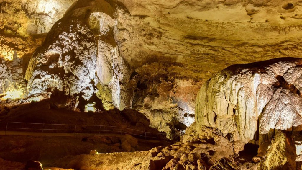
The Los Búhos Church Cave is a geological fault that is approximately 25 meters high, presumed to have formed as a result of an earthquake due to eruptions of Cotopaxi volcano.
EL BOLICHE National Recreation Area
Known for its pine and cypress plantation, covering 200 hectares and almost completely replacing the paramo.
Sigchos
Sigchos provides options for ecotourism, the Tangan Columns are ideal for rock climbing, and the Toachi Canyon provides a unique landscape to enjoy during a hike.
Sinchaguasín Lookout
An elevation located at 2,943 meters above sea level and consists of 600 steps ascending to the lookout at the top of the mountain from where you can fully appreciate the beauty of Pujilí.
Sinchaguasín Hill
Consists of 600 brightly colored steps ascending to reach the lookout at the top of the mountain, from which you can appreciate all the beauty of the area.
Devil’s Waterfall
In this area crossed the old road that connected Santo Domingo with Cotopaxi, or at a distance of 8 km. from the Palo Quemado Center towards Devil’s Waterfall.
Los Illinizas Ecological Reserve: Explore the Pristine Nature of the Andes
The Los Illinizas Ecological Reserve encompasses a diversity of ecosystems, such as the high moorlands around the Illinizas and El Corazón, and drier areas to the south, as in the Quilotoa sector. The Otonga Integral Forest contains montane cloud forests and low montane evergreen forests, with areas of regeneration and grasslands. In the Huagrahuasi-Quitasol Protective Forest, there are predominately grasslands and high Andean forests, with mixed use of grazing and associated crops. The conservation and recovery of these ecosystems to preserve their biodiversity is highlighted.
It’s outside of Cotopaxi Park, but if you want to explore Ecuador, it’s another place that can be interesting.
Accommodation in Cotopaxi
Within Cotopaxi Park, there are various facilities for the comfort and safety of visitors. These include cabins, a high mountain center, camping areas, a traveler information center, and the José Ribas Refuge, SJ. These infrastructures allow visitors to enjoy the natural beauty of the park while having basic services and accommodation options.
Stay at Haciendas or Lodges with Views of Cotopaxi
It’s worth noting that these accommodations, although not part of Cotopaxi National Park, offer exceptional experiences with their impressive views of Cotopaxi volcano and are relatively close.
In the North Area:
Some recommended accommodations in the northern area include the luxurious Tambopaxi Lodge, perfect for acclimatization and enjoying breathtaking views; The Secret Garden Cotopaxi, with unique rooms offering a one-of-a-kind nature experience; Hacienda El Porvenir, a former hacienda converted into a guesthouse with a cattle ranching history; and Hacienda Yanahurco, offering incredible landscapes and an authentic cattle farming atmosphere.
In the South Area:
Hacienda San Agustín de Callo stands out as a gem among Ecuadorian haciendas, being the oldest and preserving an Inca temple inside. Additionally, Hacienda Hato Verde, a small family hacienda, offers a charming countryside living experience.
Although these accommodations are not part of the park, they provide an excellent opportunity to enjoy the beauty of Cotopaxi from a privileged perspective.
How to Get to Cotopaxi
To reach Cotopaxi National Park, there are two main options:
- Entry through the North Control: leaving from Sangolquí to the north or from Machachi to the west. After traveling approximately 18 km or 15 km respectively, you will reach the area known as El Pedregal, where the Chilcabamba Lodge is located. From there, continue along the road to the access control, which is about 8 km further ahead. Keep in mind that these roads are gravel and may be in fair or poor condition, especially the one from Sangolquí, which can be challenging for small vehicles. A 4X4 vehicle is recommended if you choose this route.
- Entry through the Caspi Control: this access is located to the west of the volcano and is located at kilometer 42 of the Pan-American Highway. The first stretch is asphalt and lasts a few kilometers after passing the access control. Then it becomes a passable dirt track. This was the road we used when leaving Cotopaxi on the way to Quilotoa Lagoon. Keep in mind that this road is not marked on Google Maps, but the access point is. You can use apps like Maps.me that include these tracks.
In both cases, upon reaching the control, you must provide personal data for visitor registration and you will be able to access the park free of charge.
When to Visit Cotopaxi
For those planning to visit the national park, it is crucial to prepare adequately for variable conditions. The best time to visit is during the dry season, from June to September, when the routes are more accessible and the views of the volcano are clearer. It’s important to wear appropriate cold weather clothing, hiking equipment, and adhere to park regulations to ensure a safe and environmentally respectful visit.