Sierra Nevada National Park is a vast natural area located in Spain, spanning the provinces of Granada and Almería in the autonomous community of Andalusia, in the southeast of the Iberian Peninsula. About 65% of the park is in Granada and 35% in Almería, both within the Andalusian region of Spain. Given its extensive territory, Sierra Nevada includes the Sierra Nevada National Park, established in 1999, as well as the Sierra Nevada Natural Park, created in 1989. The boundaries extend from the Alpujarra Granadina to the Lecrín Valley in Granada, and from the Alpujarra Almeriense region to Los Filabres-Tabernas in Almería. With a total of 780,000 annual visitors, it is the sixth most visited national park in Spain.
Content
- 1 History of Sierra Nevada National Park
- 2 Declaration and establishment of the national park
- 3 Differences between Sierra Nevada National Park and Sierra Nevada Natural Park
- 4 Recommended excursions and activities
- 5 What to see and do in Sierra Nevada National Park
- 5.1 Mulhacén Peak
- 5.2 Hondera Lagoon
- 5.3 Yeguas Lagoons
- 5.4 Borreguiles Trail
- 5.5 Virgen de las Nieves
- 5.6 Veleta Peak
- 5.7 Caldera Lagoon
- 5.8 Hiking in Monachil
- 5.9 La Alpujarra
- 5.10 Alcazaba Peak
- 5.11 Genil River
- 5.12 Poqueira Valley
- 5.13 Sierra Nevada Ski Resort
- 5.14 Mountain Biking
- 5.15 Birdwatching and Photography
- 5.16 Botanical Gardens
- 5.17 Typical Gastronomy of Sierra Nevada (Alpujarra and Andalusia)
- 6 Main Hiking Routes
- 7 Hiking Routes for Families, Beginners, and Children
- 8 Geography of Sierra Nevada
- 9 Flora of Sierra Nevada National Park
- 10 Fauna of Sierra Nevada
- 11 Towns and Cities Near Sierra Nevada
- 12 Historical and Architectural Monuments
- 13 How to Get to Sierra Nevada
- 14 Accommodation in and around Sierra Nevada
- 15 Climate in Sierra Nevada National Park
- 16 Best Time to Visit Sierra Nevada National Park
- 17 Tips for Planning Your Visit
History of Sierra Nevada National Park
Sierra Nevada is the result of complex geological formations dating back millions of years. Its origin traces back to the collision of the African and Eurasian tectonic plates, which raised these mountains to become the highest in the Iberian Peninsula.
Declaration and establishment of the national park
Sierra Nevada National Park was declared as such in 1999, although its protection began much earlier. Conservation initiatives have been essential to preserving its rich biodiversity and unique landscapes. Although it shares the same name with another area of great interest to Spaniards and the conservation of European flora and fauna, the National Park should not be confused with the Natural Park of the same name.
Differences between Sierra Nevada National Park and Sierra Nevada Natural Park
- Sierra Nevada National Park:
- Designation: declared a National Park in 1999.
- Purpose: national parks in Spain aim primarily to conserve biodiversity and ecosystems, as well as to promote scientific research. In the national park, endemic flora and fauna and unique geological features are especially protected.
- Geographical coordinates: 37°12′0″N 3°15′0″W.
- Sierra Nevada Natural Park:
- Designation: declared a Natural Park in 1989, a category that precedes that of National Park.
- Purpose: natural parks in Spain also seek conservation but usually allow a higher degree of human activities, including the sustainable development of local communities. The natural park focuses on balancing conservation with the sustainable use of natural resources and supporting traditional activities.
Recommended excursions and activities
What to see and do in Sierra Nevada National Park
Mulhacén Peak
Pico Mulhacén, at 3,482 meters above sea level, is the highest point in the Iberian Peninsula. Its ascent is a popular challenge among mountaineers and offers impressive views of the surrounding landscape. The route to its summit is accessible to both experienced hikers and those with an intermediate level of preparation.
Hondera Lagoon
Laguna Hondera, located in the Siete Lagunas valley, is one of the most beautiful bodies of water in Sierra Nevada. Surrounded by alpine meadows and rugged peaks, it is an ideal destination for nature lovers seeking a tranquil place to enjoy the scenery.
Yeguas Lagoons
Laguna de las Yeguas is located at an altitude of 2,900 meters and is a frequent stop on high mountain hiking routes. This glacial body of water offers a serene environment and is home to various species of flora and fauna adapted to alpine conditions.
Borreguiles Trail
Camino de Borreguiles is a popular route among hikers and mountain bikers. This trail takes visitors through varied landscapes, from high mountain meadows to rocky areas, providing a diverse and enriching experience.
Virgen de las Nieves
Virgen de las Nieves is an iconic figure situated in the heights of Sierra Nevada. It is an important cultural and religious reference for the region, and its sanctuary is a place of pilgrimage and celebration, especially during local festivities.
Veleta Peak
Pico de la Veleta, with an altitude of 3,398 meters, is the second-highest peak in Sierra Nevada. It is known for its accessibility, as it is possible to drive close to its summit. From there, visitors enjoy spectacular panoramic views and direct access to high mountain routes.
Caldera Lagoon
Laguna de la Caldera is one of the most visited glacial lagoons in Sierra Nevada. Located at the foot of Mulhacén, this glacial body of water is a popular destination for hikers seeking unique and tranquil natural landscapes.
Hiking in Monachil
Monachil is an ideal destination for hiking, with routes that vary in difficulty and landscape. From the famous Cahorros, with its hanging bridges and narrow gorges, to gentler trails that traverse the surrounding fields and hills, Monachil offers something for all levels of hikers.
La Alpujarra
La Alpujarra is a picturesque region located on the slopes of Sierra Nevada. Known for its white villages, Moorish architecture, and rich culture, it is an ideal place to explore rural Andalusian life. The cobbled streets, fountains, and panoramic views make each visit an unforgettable experience.
Alcazaba Peak
Pico Alcazaba is a prominent summit located in Sierra Nevada, Spain, known for its mighty presence and panoramic views. With an altitude of 3,371 meters above sea level, it is part of the mountain range that characterizes this region of southern Europe. Its ascent offers hikers and mountaineers a challenging and rewarding experience, providing spectacular views of the surrounding peaks and mountainous landscape.
Genil River
The Genil River, one of the most significant in Andalusia, originates in Sierra Nevada and runs 336 kilometers to its mouth in the Guadalquivir River near Palma del Río, Córdoba. Its course traverses from snowy high mountains to the fertile lands of the Guadalquivir valley, providing vital water for agriculture and wildlife. With significant historical and cultural importance, the Genil is also a popular destination for recreational activities, offering locals and visitors the opportunity to enjoy its natural beauty and ecological diversity.
Poqueira Valley
Poqueira Valley is a picturesque valley located on the southern slopes of Sierra Nevada, in the province of Granada, Spain. Known for its charming white villages (Capileira, Bubión, and Pampaneira), the valley offers spectacular views of the surrounding mountains and is famous for its traditional Alpujarran architecture, with flat-roofed houses and pointed chimneys. It is a popular destination for both hikers exploring the trails and those seeking to immerse themselves in the region’s culture and natural beauty.
Sierra Nevada Ski Resort
During winter, the region becomes a popular destination for skiing and other winter sports. Sierra Nevada Ski Resort is one of the most important in Spain, offering slopes for all levels to enjoy winter sports and extraordinary scenery.
Mountain Biking
Mountain biking enthusiasts can also enjoy the national park region by following mountain bike routes. The difficulty of the trails varies depending on the chosen route.
Birdwatching and Photography
The protected environment of Sierra Nevada is an excellent place for birdwatching, with species such as the golden eagle and plans for the reintroduction of the famous bearded vulture in 2024. Landscape and wildlife photography is also very popular among visitors.
Botanical Gardens
In addition to the peaks and valleys, other points of interest include the botanical gardens of Hoya de Pedraza and the old mountain refuges, which tell the story of exploration in the region, as well as the La Cortijuela Botanical Garden.
Typical Gastronomy of Sierra Nevada (Alpujarra and Andalusia)
The gastronomy of Sierra Nevada is rich and varied, with typical dishes such as Trevélez ham, olla de San Antón, and migas. These dishes reflect the tradition and flavor of Andalusian cuisine. There are various restaurants with excellent gastronomic offerings in nearby villages like Capileira and Lanjarón, where you can find restaurants serving local cuisine and top-quality food. Recommended dishes to try:
- Iberian ham (in Spanish: Jamón ibérico).
- Burnt garlic porridge, clado colorao porridge (in Spanish: Gachas de ajo quemao, gachas de clado colorao).
- Matanzas stew (in Spanish: Guisaillo matancero).
- Chestnut stew (in Spanish: Potaje de castañas).
- Fritters (in Spanish: buñuelos).
- Fennel pot (in Spanish: Olla de hinojos).
Depending on the time of year, stews might not be a suitable option due to high temperatures.
Main Hiking Routes
Sierra Nevada offers a wide variety of hiking routes, from easy trails for beginners to more challenging routes for experienced hikers. The Sulayr Route is one of the most popular, with 300 kilometers circling the park.
Trevenque Route
This route takes hiking enthusiasts through one of the most iconic peaks in the area, Trevenque, which rises to 2,079 meters. Its pyramidal shape and dolomitic profile make it a prominent visual attraction.
- Difficulty: moderate to difficult.
- Duration: approximately 6 hours.
- Important Information: the route offers panoramic views of the Huenes and Dílar Valleys. It is recommended to wear good footwear and bring enough water due to some steep and rocky sections.
Ascent to Collado del Tajo del Contadero from Trévelez
A challenging route that starts in the picturesque village of Trévelez and ascends through pine and oak forests to reach the Collado del Tajo del Contadero at an altitude of 2,900 meters.
- Difficulty: high.
- Duration: approximately 7 hours.
- Important Information: the route offers impressive panoramic views and is ideal for experienced hikers seeking a demanding hike.
Alto del Chorrillo Route
Starting from Güéjar Sierra, this route ascends to Alto del Chorrillo, situated at 2,400 meters. The path traverses various landscapes, including forests and high mountain areas.
- Difficulty: difficult.
- Duration: approximately 5 hours.
- Important Information: it is recommended to bring enough water and be prepared for weather changes. The views from Alto del Chorrillo are spectacular.
Peñón del Lobo Route from Lanteira
This route begins in Lanteira and ascends to Peñón del Lobo. It is known for its panoramic views of Sierra Nevada and the surrounding valleys.
- Difficulty: medium.
- Duration: approximately 4 hours.
- Important Information: the final stretch is steep and rocky, so caution is recommended. The views from the top reward the effort of the climb.
Sulayr Route
The Sulayr Route, also known as the GR-240 Trail, is a circular route covering 300 kilometers around Sierra Nevada, making it the longest trail in Spain. This path passes through both Sierra Nevada National Park and Natural Park, offering an impressive combination of mountainous landscapes, valleys, and picturesque villages. Divided into 19 stages, each offers a unique experience of the region’s geography and biodiversity.
- Difficulty: varies from medium to high depending on the stage. Overall, it is a demanding route due to its length and mountainous terrain.
- Duration: between 15 and 19 days to complete the entire route.
- Important Information: the average altitude of the trail is 1,800 meters, reaching significant heights in several stages. The route is well marked and was homologated in 2008. Along the way, hikers can find various public facilities, such as the El Dornajo Visitor Center and the La Cortijuela Botanical Garden, which enrich the experience with additional information about the local flora and fauna.
Main Stages of the Sulayr Trail:
- Visitor Center "Dornajo" – Forest House "La Cortijuela"
- Difficulty: Difficult
- Distance: 15 km
- Duration: 5-6 hours
- Forest House "La Cortijuela" – Rinconada de Nigüelas
- Difficulty: Difficult
- Distance: 19 km
- Duration: 4-5 hours
- Puente Palo – Capileira
- Difficulty: Difficult
- Distance: 11 km
- Duration: 5-6 hours
- Capileira – Trevélez
- Difficulty: Arduous
- Distance: 17 km
- Duration: 5-7 hours
- Postero Alto – Peña Partida
- Difficulty: Difficult
- Distance: 16 km
- Duration: 5-6 hours
Each stage of the Sulayr Trail offers a mix of challenges and rewards, from panoramic views of the high peaks to encounters with the region’s rich biodiversity. Good physical and logistical preparation is essential to fully enjoy this route.
Hiking Routes for Families, Beginners, and Children
The park also offers accessible routes for families and beginners, such as the Sendero de la Estrella. These routes are shorter and less demanding, ideal for enjoying a day outdoors with children.
Sendero de la Estrella (Star Trail)
Sendero de la Estrella (in english: Star Trail), is one of the most accessible and popular routes in Sierra Nevada, perfect for families and beginners. This trail follows the old mining road along the Genil River valley, offering spectacular views of the highest peaks in Sierra Nevada without requiring excessive effort.
- Difficulty: easy.
- Duration: approximately 4-5 hours round trip.
- Important Information: the trail is mostly flat and well-marked, ideal for enjoying a day outdoors with children. Along the way, you can see remnants of mining activity and enjoy the natural beauty of the valley.
Dílar River Trail
This trail follows the course of the Dílar River and is ideal for families with young children due to its easy access and gentle terrain. Along the way, hikers can enjoy riparian vegetation and small waterfalls.
- Difficulty: easy.
- Duration: approximately 2-3 hours round trip.
- Important Information: the path is wide and well-marked, with rest areas and picnic spots where families can have a meal. It is an excellent option for a short, relaxing hike.
The Cahorros de Monachil Trail
This route offers an exciting experience for the whole family, with hanging bridges and narrow gorges along the Monachil River. Despite its unique features, it is an accessible and not overly demanding trail.
- Difficulty: easy to moderate.
- Duration: 3 to 4 hours round trip.
- Important Information: the trail includes several fun attractions for children, such as hanging bridges and small waterfalls. It is important to wear suitable footwear for some rocky parts of the path.
Enchanted Forest Trail
Located near the recreation area of Puerto de la Ragua, this short and simple route takes hikers through a beautiful forest of pine and oak trees. It is perfect for families looking for a peaceful walk in a natural setting.
- Difficulty: easy.
- Duration: 1 to 2 hours round trip.
- Important Information: the trail is well-maintained and marked, with areas to sit and enjoy the scenery. It is an ideal option for introducing children to hiking.
Poqueira Acequias Trail
This trail follows the ancient irrigation channels that water the fields of La Alpujarra, offering impressive views of the white villages and the surrounding landscape. It is an easy and educational route, perfect for families.
- Difficulty: easy.
- Duration: 3 to 4 hours round trip.
- Important Information: the trail is well-marked and relatively flat, making it accessible for children and beginners. It is an excellent way to combine physical activity with learning about local history and culture.
Geography of Sierra Nevada
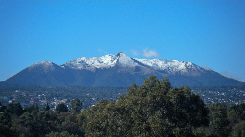
The park covers a vast mountainous area, with peaks exceeding 3,000 meters in altitude. Its varied geography includes deep valleys, glacial lagoons, and extensive alpine meadows, stretching from La Alpujarra to El Marquesado and the Lecrín Valley, covering a total area of 85,883 hectares.
In this park, there are more than 20 peaks over 3,000 meters high, with notable ones being Mulhacén (3,479 m), a recommended visit, Veleta (3,396 m), and Alcazaba (3,371 m).
The rivers originating on the northern face of the Sierra feed into the Guadalquivir basin, with the most significant being the Fardes and the Genil. On the other hand, the rivers flowing from the western and southern faces empty into the Mediterranean, including the Dúrcal, Ízbor, Trevélez, and Poqueira rivers, all tributaries of the Guadalfeo, which also originates in Sierra Nevada, as well as the Adra and Andarax rivers with their respective tributaries.
On the southern and western faces are most of the nearly 50 high mountain lakes present, many of which are also sources of streams and rivers. Much of the landscape, especially above 2,400 meters (the snow line before the Holocene), has been sculpted by glacial action, creating the characteristic U-shaped valleys that are distinctive of the region.
Flora of Sierra Nevada National Park
The flora of the park is extremely diverse, with more than 2,100 species of plants. Many of these species are endemic, adapted to the harsh conditions of high mountains.
The flora and vegetation of Sierra Nevada National Park have exceptional diversity, with unique plant species due to its location and geological history.
Of the 2,100 plant species cataloged in the park, more than 60 are endemic, meaning they are found exclusively in this region. Among the emblematic plants is the Plantago nivalis, known as the Star of the Snows, and threatened species such as the Artemisia granatensis, a subspecies of gentian endemic to marshes.
Fauna of Sierra Nevada
The park’s fauna includes mammals such as the Spanish ibex and wild boar, as well as a variety of birds of prey and small reptiles. This Andalusian region of Spain is a refuge for many endangered animal species.
The park is home to a thriving population of Spanish ibex, a significant number of wild boars, martens, badgers, and wild cats. Native birds include the golden eagle, Bonelli’s eagle, common kestrel, little owl, Eurasian eagle-owl, and many more species of birds and smaller birds such as goldfinches, serin, ortolan bunting, and red-legged partridge among the most important.
These species have found in Sierra Nevada a suitable habitat to thrive, contributing to the park’s natural wealth. Additionally, on the boundaries of the protected area is the La Cortijuela Botanical Garden, where research and conservation plans for the region’s endemic species are carried out.
Towns and Cities Near Sierra Nevada
The white villages of La Alpujarra, located on the slopes of Sierra Nevada, are known for their beauty and charm. Places like Pampaneira and Capileira offer an authentic view of rural Andalusian life.
Historical and Architectural Monuments
In addition to its natural wealth, the park and its surroundings are home to important historical and architectural monuments, such as the Alhambra in Granada, a testament to Moorish history in Spain that, if it is your first visit to the region, is always recommended to visit the Alhambra.
How to Get to Sierra Nevada
The park is accessible from several major cities, such as Granada and Almería. You can reach it by car, bus, or even train, depending on your starting point.
By Bus from Granada
There is a bus line from Granada to Sierra Nevada (Autocares Tocina), with schedules from 8:00 AM to 5:15 PM in summer and from 9:00 AM to 6:30 PM in winter.
By Train
Access to Sierra Nevada by train can be done by arriving at the following train stations:
- Renfe Granada: 40 kilometers away.
- Renfe Málaga: 163 km.
- Renfe Sevilla: 268 km.
If you do not have a car, it is ideal to arrive at Granada train station as it is the closest.
By Plane
The nearest airport is in Granada, about 47 km away.
- Granada Airport: 47 km.
- Málaga Airport: 172 km.
- Seville Airport: 291 km.
By Car
Reaching Sierra Nevada by car is a popular option due to the flexibility and time availability it offers.
From Granada
- Main Route: Take the A-395, the road that goes directly from the city of Granada to the Sierra Nevada ski resort. The distance is approximately 32 kilometers, and the journey takes around 40-45 minutes.
- Directions: Leave Granada heading south on the A-395. Follow the signs to Sierra Nevada and continue on the A-395 until you reach the ski resort.
From Almería
- Main Route: Take the A-92 west towards Granada and then follow the signs to the A-395.
- Directions: From Almería, take the A-92 towards Granada. Once in Granada, follow the signs to the A-395, which will take you directly to the national park.
From Málaga
- Main Route: Take the A-45 north and then the A-92 east towards Granada. From Granada, follow the signs to the A-395.
- Directions: From Málaga, take the A-45 towards Antequera. Then, take the A-92 towards Granada. In Granada, follow the signs to Sierra Nevada on the A-395.
Driving Tips
The roads can be winding and steep, especially in the final stretches of the A-395. In winter, it is important to check weather conditions and carry snow chains if necessary.
Regarding vehicle parking, there are several parking options near the ski resort in Sierra Nevada. It is recommended to arrive early, especially during peak season, to secure a good parking spot.
Make sure to fill up your fuel tank before starting the ascent, as service stations are limited on the mountain roads.
Traveling by car allows you to enjoy the scenery and make stops at your own pace, resting, taking photographs in designated rest areas, and having a more personal and rewarding experience.
Accommodation in and around Sierra Nevada
There are numerous accommodation options available, from mountain hotels to cozy hostels in nearby villages. Many of these places offer spectacular views and a peaceful atmosphere. Here are some nearby villages ideal for staying due to their proximity or tourist interest, allowing you to visit the national park comfortably and easily:
Guejar Sierra
Located about 16 kilometers from Granada, Guejar Sierra is known for its impressive natural landscapes, including Sierra Nevada National Park and the Canales Reservoir. This village offers a wide variety of outdoor activities, such as hiking and winter sports, thanks to its proximity to the ski resort.
Accommodation in Guejar Sierra offers good deals in rural houses and small hotels, providing an authentic and cozy experience.
Distance: approximately 20 kilometers.
Pinos Genil
This charming village, divided by the Genil River, is perfect for hiking and fishing enthusiasts. Pinos Genil is just a few kilometers from the city of Granada, making it very accessible. Additionally, the village has a rich gastronomic and cultural offer, with numerous bars and restaurants serving typical regional dishes.
Accommodations in Pinos Genil include rural houses and hostels, allowing visitors to enjoy a peaceful and picturesque environment.
Distance: approximately 18 kilometers.
Quéntar
Quéntar is a small and picturesque village located about 20 kilometers from Granada, surrounded by mountains and impressive natural scenery. The Aguas Blancas River, ideal for hiking, runs through the village, and several hiking routes start here.
Quéntar offers accommodation in rural houses and small hostels, perfect for those seeking tranquility and an authentic natural environment.
Distance: approximately 30 kilometers.
Monachil
Monachil is known for its proximity to the Sierra Nevada Ski Resort. Besides winter activities, you can enjoy hiking and other outdoor activities in summer. The village offers a varied range of restaurants and historical sites, such as the Church of the Incarnation.
There are hotels, rural houses, and apartments available, all well-located for easy access to the ski resort and hiking trails.
Distance: approximately 8 kilometers.
Capileira
Situated on the southern slope of Sierra Nevada, Capileira is one of the highest villages in Spain and stands out for its typical Alpujarra architecture with white houses and slate roofs. This village is ideal for those looking to explore both the mountains and the local culture.
Capileira offers a wide range of accommodations, including hotels, hostels, and rural houses, providing a comfortable and charming base for exploring the region.
Distance to Sierra Nevada: approximately 37 kilometers.
Lanjarón
Known as the spa town, Lanjarón is famous for its medicinal waters and spa. The quality of its water is well-known among Spaniards, with a bottled water brand carrying its name. It is a perfect place to relax and enjoy nature, with numerous springs and fountains in the area.
Lanjarón has several hotels, rural houses, and spas with included accommodations, allowing visitors to enjoy a relaxing stay in a natural and healthy environment.
Distance: approximately 40 kilometers.
Climate in Sierra Nevada National Park
The climate in Sierra Nevada varies significantly with altitude. The lower areas have a Mediterranean climate, while the higher peaks experience alpine conditions, with snow persisting for much of the year, cold winters, and hot summers marked by severe drought in July and August.
As the protected area has zones with well-differentiated altitudes, the average annual temperature decreases significantly as one ascends: from about 12-16ºC below 1,500 meters above sea level to around 0ºC above 3,000 meters.
Regarding rainfall, the average annual precipitation is around 600 mm, reflecting a climate where water scarcity is an important characteristic for much of the year.
Best Time to Visit Sierra Nevada National Park
The best time to visit Sierra Nevada varies greatly depending on the type of activity you wish to undertake.
Spring and autumn are ideal for hiking, exploring the fauna and flora, and enjoying trekking activities in nature.
Winter is perfect for skiing, snowboarding, and winter activities such as snowshoeing in the mountains.
Tips for Planning Your Visit
To ensure a smooth visit to the national park, it is important to plan ahead, booking accommodations well in advance as places in the villages and towns near the protected area and ski resort can fill up quickly during peak season. It is also important to check weather conditions if planning to access the higher areas of the park.